Research Project 3: Paleocurrents in a synorogenic
basin
Part 1 - Plotterkill Preserve
Geology 21: Stratigraphy and Depositional Environments
of New York
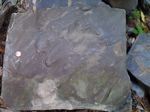
Overview: The Plotterkill Preserve is a private preserve that surrounds the lower reaches of the Plotterkill stream which drains north into the Mohawk River. The stream cuts into beautifully exposed sandstone and shale of the Middle Ordovician Schenectady Formation - this unit lies above the Utica Shale examined in the previous week. Several nick points in the stream are caused by thick and resistant sandstone beds. A nick point is a sharp change in the streams gradient (i.e. a waterfall) caused by the relative resistance of the underlying rocks. In this area, the Schenectady Formation is underlain by the Utica Shale, and together their thickness is nearly 1000 to 1800 meters. This shale/sandstone package thins gradually to the west and thickens dramatically to the front (east edge, near Troy) of the Taconic Range. The extreme thickness and the composition of these strata is an important sedimentation pattern.
The thickness of strata preserved in a basin is generally a reflection of the relative depth or the amount of subsidence that occurred in the basin - accommodation space. With this in mind, one could postulate that the basin was deepest, or experienced the most subsidence from here (Plotterkill) east to the Troy area where the unit thickens considerably. Shale that filled the basin has no obvious provenance or source area because the particles are so fine grained. Sandstones, on the other hand, contain coarse-clastic material that represents identifiable fragments of the source region. Because these and correlative sandstones have a distinct composition, workers have postulated that these sandstones had a source that lay to the east and it was a volcanic arc terrane (why?). Sandstones of the Schenectady Formation contain quartz, feldspar, rock fragments (including volcanic rock fragments), and a minor amount of detrital mica.
Although many geologists accept the notion that the clastic material had a source to the east, the paleocurrent data from this unit does not clearly support this contention. Using data collected from the Plotterkill Preserve and data from several other sites in the Mohawk Valley (see attached) you will be able to reconstruct the paleoflow directions within the basin during deposition. You will have three separate data sets, one from the lower Schenectady Formation, one from the middle Schenectady Formation (Plotterkill Preserve), and one from the upper Schenectady Formation.
Age: The Schenectady Formation is Mohawkian in age (upper Middle Ordovician). Most of the formation (and the Utica Shale) is restricted to the Nowadagan stage but the lower beds belong to the Canajoharian stage (i.e. the top of the Mohawkian).
Objectives: The objectives of this lab report are: 1) interpret the depositional environments of the Plotterkill section; 2) to identify and measure paleocurrent indicators in turbidites; and 3) to plot and present these data in a accurate and coherent manner. The goal of this lab project is to understand the nature of the basin and basin infilling and source regions during the upper Middle Ordovician and relate this to tectonic events during this time.
Procedure: Describe bed thickness, sedimentary structures, sandstone to shale ratios, and bed coarsening and thickening trends. In order to measure paleocurrent indicators, unidirectional and bidirectional sedimentary structures must first be identified. We will be concerned primarily with flutes, grooves, ripple cross-lamination and parting lamination.
B] Grooves are bidirectional sole marks. Grooves are elongate nearly
straight marks on the base of sandstone beds. They are not asymmetric and
they therefore simply indicate the orientation of the current but not the
absolute direction (See Boggs, p. 171).
C] Parting lineation is a bidirectional current indicator that occurs
on the split surface of parallel laminated sandstone beds. It occurs as
a lineation parallel to the paleoflow direction and it is produced by mineral
alignment during deposition. Excellent examples of parting lineation can
be seen along the walkway just outside the Schaffer Library. (See Boggs,
p. 184.)
D] Ripple cross-lamination is a unidirectional current indicator that
occurs on the top of turbidite beds, among other places. As turbidites
slow they produce planar laminated bedding and further slowing of the current
produced rippling of the sandstone. A cross-section of the ripples in a
sandstone bed will display small (mm- to cm-scale) inclined forset laminae
that are inclined in the direction of ripple migration and current movement.
Ripple cross-lamination will be difficult to find in the Schenectady Formation.
Office work: Summarize your data in a typed table (Table 1). Both your data table and the additional data (Table 2) should be included in your report as separate tables. Plot unidirectional and bidirectional data separately for each location and place these plots on a map so that the spatial distribution of the paleocurrents can be inspected on one figure. Make sure that bidirectional and unidirectional current indicators are plotted separately. Photocopy the map with the different rose diagrams affixed to the map at their proper location. Create one 'grand rose' which has all of the paleocurrent data (Plotterkill only). Both the map with the paleocurrent information and the grand paleocurrent rose should be separate figures in your writeup.
Make sure that you have gone through the web pages: "Mohawk Valley Fossils" accessible from the class home page. (http://zircon.geology.union.edu/Strat/strat.info)
Writeup: Your typewritten lab report, which will be combined
with analyses from next week (Visher Ferry and the following week at Minneweska
State Park), should include the following:
1) Introduction, including site location, formation name and age of the rocks studied, purpose of the trip and the approach to the problem. Do not write this as a narrative! Be factual in your introduction.2) Presentation of the data. Describe the sequence in full. Refer to the data tables and the rose diagrams. In general terms what does the data tell you the flow directions was? Is there any significant variation in flow direction between different localities? Is there any variation as you move upsection? Is there any variation between different types of current indicators?
3) Interpretation of the data. A) What is the depositional environments of this section? B) What does the paleocurrent pattern mean. If the clastic sediments were derived from the Taconic Mountains, what was the probable path they needed take to arrive at their present position? What implications do these data have for the shape and extent of the basin? A sketch map may help you make your point.
4) Conclusion. What is the significance of this unit with respect to the other units studied thus far? Is clastic sediment with this composition present in any other units?
5) A map with all the paleocurrent information summarized. (No paste ups!)
6) A rose diagram with all the paleocurrent information.
7) Data tables with your data and the additional data. Table 1 is your data, Table 2 is the additional data.
8) Optional. A diagram showing the inferred depositional environment of the Schenectady Formation with paleoflow directions.
Table 2: Paleocurrent data collected from adjacent areas, Schenectady Fm. (Ordovician)
[A] - Bidirectional sole
marks from the lower Schenectady Formation
(off Rt 5, slightly north of the town of Hoffmans at Wolf Hollow).
Data collected by Paul Ryberg.
146 345 343 027 026 030 039 290 280 023 010
350 020 015 045 075 330 020 016 014 340 091
030 042 099 057 205 195 225 220 200 198 202
280 200 195 230 190 210 160 010 020 010
[B] - Bidirectional sole marks from the upper Schenectady Formation
(outcrops along I-88, east of Schoharie).
Data collected by Paul Ryberg.
088 146 350 357 286 355 014 001 065 070 020
330 330 330 345 352 002 340 042 335 355 317
297 300 330 335 320 323 015 020 010 022 028
050 030 312 332 330 004 358 325 315
[C] - Grooves (bidirectional sole marks) and flutes (unidirectional) from the Schenectady Formation (outcrops at 87 and the Mohawk River). From medium- to thick-bedded, medium- to coarse-grained sandstones with interbedded siltstone. Data collected by John I. Garver.
250F 242G 235G 260G 250G 248G 257G 205G 254G
[D] - Grooves (bidirectional sole marks) from the Schenectady Formation (the town of Crescent and the Mohawk River). From gray-weathering, medium- to thick-bedded, medium- to coarse-grained sandstones (Tabc) and interbedded laminated siltstones. Data collected by John I. Garver.
145G 152G 090G 190G 132G 135G 120G 133G 123G 143G
© Geology Department, Union College, Schenectady
N.Y. 12308-3107.
All rights reserved. No part of the document can be copied
and/or redistributed,
electronically or otherwise, without written permission
from the
John I. Garver, Geology Department, Union College, Schenectady
NY, 12308-2311, USA.
Last Revised By: Geology Department, September 2000