.(B) MANNY'S CORNER (Lower to Middle Ordovician, Knox Unconformity)Handout: Costanzo's Farm Data: Paleocurrent measurements from Rt. 29, middle Galway Fm. Data: Paleocurrent measurements from Costanzo's farm, Mosherville sandstone Member of the Galway Fm. Photo: Scour of conglomerate into sandstone bed, Potsdam Fm. Photo: Limestone conglomerate in Galway Fm. (Rt. 29) 1 of 2 Photo: Limestone conglomerate in Galway Fm. (Rt. 29) 2 of 2 Photo: Stromatolites in Galway Fm. (Rt. 29) Photo: Cross-bedded sandstone in Galway Fm. (Rt. 29) 1 of 2 Photo: Cross-bedded sandstone in Galway Fm. (Rt. 29) 2 of 2 Photo: Cross-bedded sandstone in MoshervilleMember of Galway Fm. All high-quality photos (folder of JPEG files - Costanzo photo prefaced by #1) Plot of Paleocurrents (Word file)
.Handout: Manny's Corner Photo: Algal accumulation, Wolf Hollow Member, upper Beekmantown Gp. Photo: Fossils in the Amsterdam Formation Photo: Bedding attributes in the Glens Falls Ls (Rt. 67) Photo: Abrupt contact between Lowville Ls and the Amsterdam Ls. 1 of 2 Photo: Abrupt contact between Lowville Ls and the Amsterdam Ls. 2 of 2 Photo: Micrite of Lowville Ls that has mudcracks and birdseye vugs Photo: Student measuring strata at Lowville and Amsterdam Ls. contact
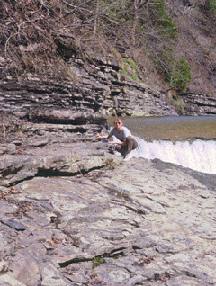
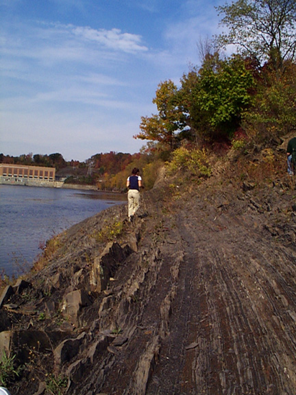
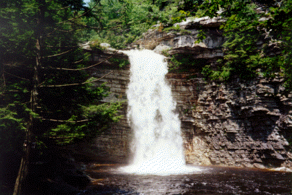
.Handout: Canajoharie Creek Photo: Disrupted laminations, Upper Beekmantown Group. Photo: Utica Shale at Wintergreen Park Photo: Floral Ave general stratigraphic sequence Photo: Floral Ave uncf. with unconformity drawn Photo: Orange weathering bentonite in the Utica Shale, Wintergreen Park Photo: Knox Unconformity, Floral Ave, Canajoharie Creek, at waterfall
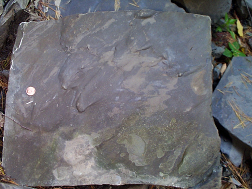
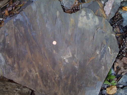
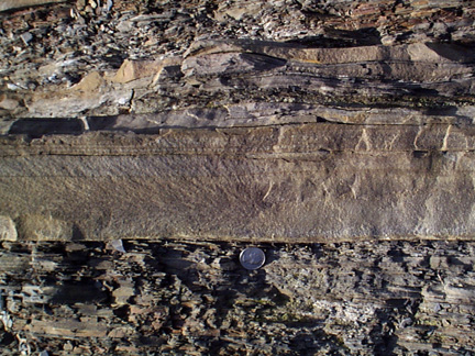
.Handout: Plotterkill Photo: Bedding relationships at base of Lower Falls Photo: Flutes_1 Photo: Flutes_2 Data: Paleocurent data from adjacent areas (text file) Data: Data collected this year (Table) Data: Flutes and grooves from Plotterkill
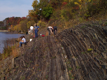
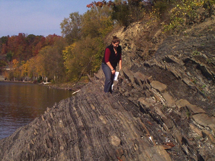
(4) GUNKSHandout: Visher Data: Flute and ripples from the same bed - Data (1994) Excel Table Data; Flute and ripples from the same bed - Data (text file) Data: Data collected this year (Table) Photo: Vertical sandstone beds (single person) Photo: Vertical sandstone beds (group) Photo: Graded bed Photo: Vertical sandstone beds (Heather)
.
© Geology Department, Union College, Schenectady
N.Y. 12308-3107. All rights reserved. No part of the document can be copied
and/or redistributed,
electronically or otherwise, without written permission
J.I. Garver, Geology Department, Union College, Schenectady NY, 12308-2311,
USA.
Last Revised: Geology Department, September 2001